
From raw data to concrete information
Data, data and more data. An awful lot of data is being collected, but often it stops there. Extracting concrete information from that data is still a step too far for many organizations. As a distributor and Diamond Partner of Hexagon Geospatial, IMAGEM helps companies make that translation.
Especially in the infrastructure sector, the possibilities are unprecedented. What about automatically detecting subsidence of roads or objects, for example? Or using data to predict when a sewer network will reach the end of its service life?
IMAGEM is the face of Hexagon in the Benelux region. "Hexagon AB is the world's largest company in the field of precision geospatial measurement technologies," said Patrick de Groot of IMAGEM. The company specializes in measuring and processing all kinds of the data, from nanometers in factories to area coverage from satellites. IMAGEM uses Hexagon's technology to help users, managers and policy makers make data-driven decisions. "We do this within the core themes of Data Automation, Digital Twin and Steering Information. This includes processing raw (sensor) data into actionable information, which can be used to create a digital copy of physical objects and which helps make data-driven decisions. In the infrastructure sector, we notice a growing interest in asset monitoring. With our technologies and the use of satellite data, for example, we can provide perfect insight into the status of various assets and whether anything has changed since a previous measurement moment. It is of value that cannot be underestimated."
In the infrastructure sector, IMAGEM is noticing a growing interest in asset monitoring.
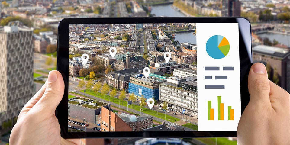
Clear dashboards
"Basically, we collect data from satellites, aerial photos and ground-based sensors that we translate into concrete information for our customers in clear dashboards," De Groot explains. He gives some concrete practical examples. "In 2019, we ran a pilot for the Department of Public Works by mapping subsidence measurements of certain assets based on satellite images. The results were compared with those of the traditional measurements that Rijkswaterstaat carries out on a planned basis. It turned out to be a good match. Using this technology, Rijkswaterstaat can phase out planned measurement and transform it into data- and risk-based management. It saves an awful lot of time and prevents unnecessary visits. It is also possible to prioritize asset maintenance based on this data."
Turning data into value
IMAGEM's technology can also provide relief for project progress. De Groot: "For example, we can plot the condition of a sewage network in time against the condition of the material (economic lifespan) and predict when it is due for replacement. In turn, we can combine that information with what is happening at ground level. After all, construction activities and excavations can be disruptive factors." IMAGEM is also proving its added value with water boards such as Drents Overijsselse Delta to look at the degree of ingrowth at ditches. "That used to be done manually where 60 employees were sent into the field for a week. We have proven that we can deliver the same result with our satellite images, using machine learning to scan the entire area based on a limited set of observations. The water board can reduce staff deployment at those times by 75%. These are just a few examples of the many efficiencies we can realize by extracting value from raw data," De Groot concludes.
Contact gegevens
Louwers Mediagroep
Schatbeurderlaan 6 6002 ED
Weert Netherlands
Kapelle Street 132/1
Building G
8020 Oostkamp Belgium
Social
Vragen? Neem dan direct contact met ons op
Contact © 1987 - 2025 Louwers Media Group.